 Google Maps
 Waze
Health
Jitra Hospital
1.3 km≈ 3 min drive
Via Jalan Utama and Jalan Jitra
Google Maps ·
Directions from homestayJITRA, KEDAH
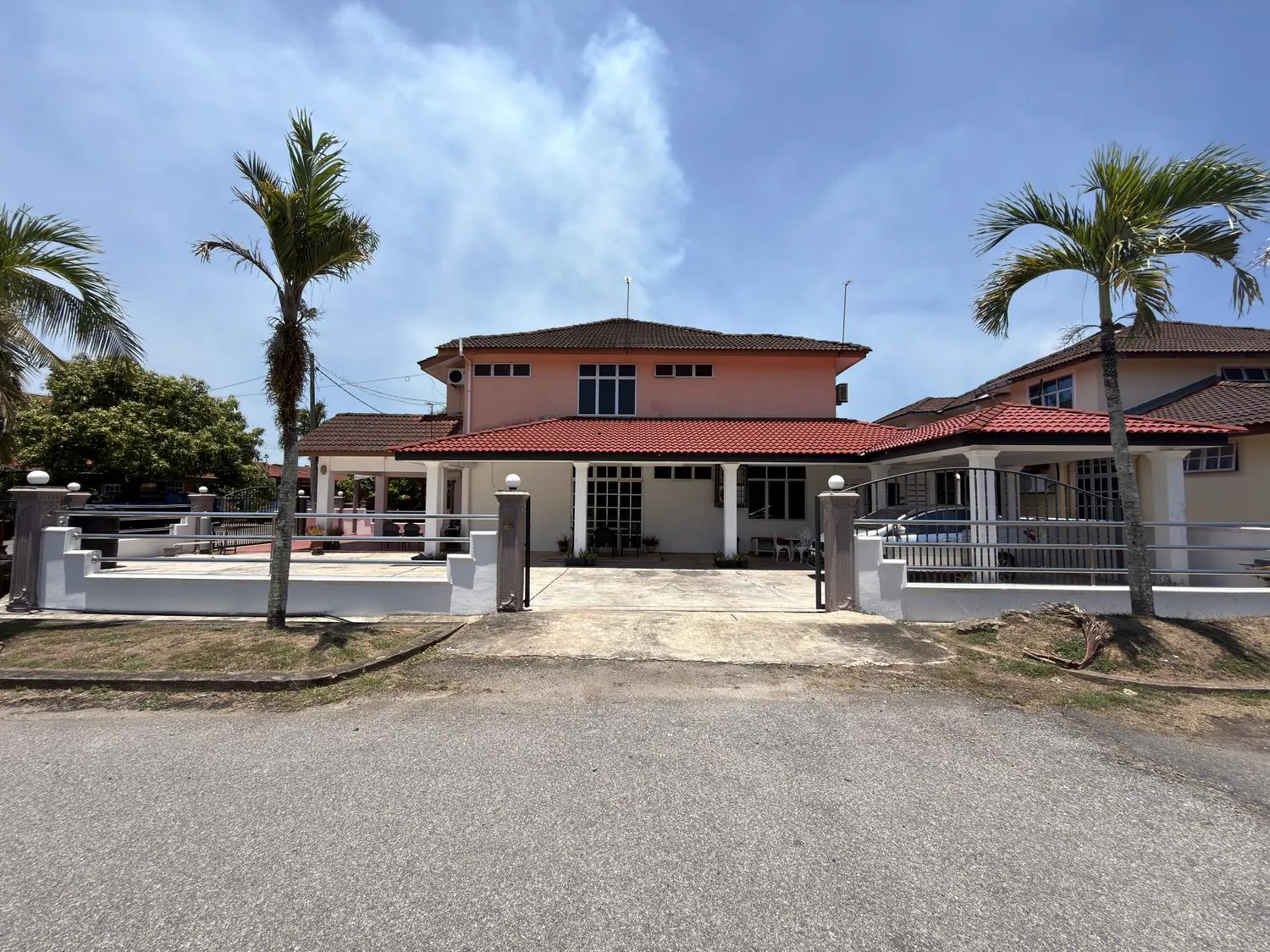
Beside the side fence of Jitra Hospital. Explore the house location on the map, then open your preferred app for directions.
Zoom and move the map to explore the neighbourhood.
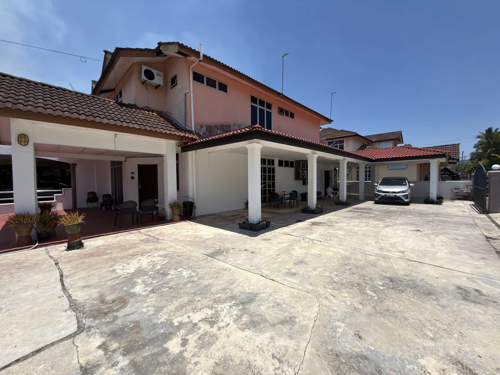
The house compound usually fits 3 to 4 cars.
Explore places by category or search for a destination. Open driving directions straight from Jitra2Stay.
Place categories
Search within the selected category.
Health
1.3 km≈ 3 min drive
Via Jalan Utama and Jalan Jitra
Google Maps ·
Directions from homestayEducation
30.8 km≈ 34 min drive
Via Lebuhraya Utara - Selatan/AH2/E1 and Route 276
Google Maps ·
Directions from homestayTransport
16.4 km≈ 19 min drive
Via Lebuhraya Utara - Selatan/AH2/E1 Tolls
Google Maps ·
Directions from homestayEducation
6.3 km≈ 11 min drive
Via Jalan Jitra/Route 1
Google Maps ·
Directions from homestayEducation
7.1 km≈ 12 min drive
Via Jalan Jitra/Route 1
Google Maps ·
Directions from homestayShopping
4.2 km≈ 9 min drive
Via Jalan Jitra/Route 1
Google Maps ·
Directions from homestayEducation
3.2 km≈ 6 min drive
Via Jalan Jitra
Google Maps ·
Directions from homestayEducation
3.4 km≈ 6 min drive
Via Jalan Jitra
Google Maps ·
Directions from homestayPlaces to visit
10.2 km≈ 12 min drive
Via Lebuhraya Utara - Selatan/AH2/E1 Tolls
Google Maps ·
Directions from homestayPlaces to visit
10.4 km≈ 13 min drive
Via Lebuhraya Utara - Selatan/AH2/E1 Tolls
Google Maps ·
Directions from homestayPlaces to visit · Mosques
24.9 km≈ 27 min drive
Via Lebuhraya Utara - Selatan/AH2/E1 Tolls
Google Maps ·
Directions from homestayTowns
26.2 km≈ 27 min drive
Via Lebuhraya Utara - Selatan/AH2/E1
Google Maps ·
Directions from homestayEducation
1.1 km≈ 3 min drive
Via Jalan Utama and Jalan Jitra
Google Maps ·
Directions from homestayHalls
1.2 km≈ 4 min drive
Via Jalan Utama and Jalan Jitra
Google Maps ·
Directions from homestayMosques
1.1 km≈ 3 min drive
Via Jalan Utama
Google Maps ·
Directions from homestayHalls
3.8 km≈ 9 min drive
Via Jalan Jitra
Google Maps ·
Directions from homestayHalls
3 km≈ 7 min drive
Via Jalan Jitra
Google Maps ·
Directions from homestayAgencies & camps
3.3 km≈ 7 min drive
Via Jalan Jitra
Google Maps ·
Directions from homestayAgencies & camps
1.7 km≈ 4 min drive
Via Jalan Jitra
Google Maps ·
Directions from homestayHotels
2.7 km≈ 5 min drive
Via Jalan Jitra/Route 1
Google Maps ·
Directions from homestayTowns
2.7 km≈ 5 min drive
Via Jalan Jitra/Route 1
Google Maps ·
Directions from homestayTowns
7 km≈ 13 min drive
Via Jalan Jitra/Route 1
Google Maps ·
Directions from homestayEducation
6 km≈ 11 min drive
Via Jalan Jitra/Route 1 and Jalan Ilmu
Google Maps ·
Directions from homestayEducation
6.9 km≈ 12 min drive
Via Jalan Jitra/Route 1
Google Maps ·
Directions from homestayShopping
5.9 km≈ 12 min drive
Via Jalan Jitra/Route 1
Google Maps ·
Directions from homestayShopping
5.7 km≈ 11 min drive
Via Jalan Jitra/Route 1
Google Maps ·
Directions from homestayMosques
6.6 km≈ 13 min drive
Via Jalan Jitra/Route 1
Google Maps ·
Directions from homestayHotels
6.6 km≈ 13 min drive
Via Jalan Jitra/Route 1
Google Maps ·
Directions from homestayAgencies & camps
7.3 km≈ 13 min drive
Via K273
Google Maps ·
Directions from homestayAgencies & camps
Choose your intended army camp in Google Maps.
Choose a location in MapsEducation
7.8 km≈ 14 min drive
Via Jalan Jitra/Route 1
Google Maps ·
Directions from homestayMosques
8.7 km≈ 11 min drive
Via Lebuhraya Utara - Selatan/AH2/E1 Tolls
Google Maps ·
Directions from homestayHotels
Check the intended hotel name in Google Maps.
Choose a location in MapsPlaces to visit
8.1 km≈ 15 min drive
Via K273
Google Maps ·
Directions from homestayMosques
12.1 km≈ 13 min drive
Via Lebuhraya Utara - Selatan/AH2/E1 Tolls
Google Maps ·
Directions from homestayEducation
13.8 km≈ 16 min drive
Via Lebuhraya Utara - Selatan/AH2/E1 Tolls
Google Maps ·
Directions from homestayTowns
17.8 km≈ 20 min drive
Via Lebuhraya Utara - Selatan/AH2/E1 and Route 1 Tolls
Google Maps ·
Directions from homestayPlaces to visit
20.2 km≈ 22 min drive
Via Lebuhraya Utara - Selatan/AH2/E1 and Route 1 Tolls
Google Maps ·
Directions from homestayTowns
24.7 km≈ 26 min drive
Via Lebuhraya Utara - Selatan/AH2/E1 Tolls
Google Maps ·
Directions from homestayTowns
17.5 km≈ 20 min drive
Via Lebuhraya Utara - Selatan/AH2/E1
Google Maps ·
Directions from homestayEducation
19.4 km≈ 22 min drive
Via Lebuhraya Utara - Selatan/AH2/E1
Google Maps ·
Directions from homestayEducation
Choose your intended UniMAP campus in Google Maps.
Choose a location in MapsEducation
31.6 km≈ 34 min drive
Via Lebuhraya Utara - Selatan/AH2/E1
Google Maps ·
Directions from homestayAgencies & camps
Choose your intended MARDI branch in Google Maps.
Choose a location in MapsEducation
31 km≈ 34 min drive
Via Lebuhraya Utara - Selatan/AH2/E1 and Route 276
Google Maps ·
Directions from homestayHotels
27.2 km≈ 30 min drive
Via Lebuhraya Utara - Selatan/AH2/E1 and Route 276
Google Maps ·
Directions from homestayEducation
26.2 km≈ 29 min drive
Via Lebuhraya Utara - Selatan/AH2/E1
Google Maps ·
Directions from homestayEducation
28.2 km≈ 29 min drive
Via K103 Jalan Kampung Bukit Kechik
Google Maps ·
Directions from homestayEducation
30.2 km≈ 38 min drive
Via K262 Jalan Kampung Telok Tenggiri and Jln Kodiang/Route 176
Google Maps ·
Directions from homestayEducation
31.2 km≈ 39 min drive
Via Jln Kodiang/Route 176
Google Maps ·
Directions from homestayNo matches in this list. Try a shorter name or clear the search to see every place.
Shown distances and times are driving-route estimates observed in Google Maps, not straight-line distances. Routes, entrances and traffic may change your journey; check the destination in Maps before leaving.
For a specific destination’s driving distance, time and check date, refer to the route cards above.
Explore places by area and the purpose of your visit.
Beside the side fence of Jitra Hospital, convenient for hospital visits and accompanying family.
Pusat Giat Mara, Dewan Jitra, Masjid Sharifah Fatimah, IKBN Jitra, MRSM Kubang Pasu, Dewan Tunku Anum, Dewan Wawasan, MPKP, Kubang Pasu Police HQ, Hotel Bustani, Lotus Jitra and Jitra town.
Bandar Darulaman, ILP Jitra, POLIMAS, IPG Darulaman, Northern Branch IAB, C-Mart BDI, Yawata, Masjid Muttaqin, Hotel Darulaman, Kem Kelubi, Malay Army Camp and SMSAH/Jenan.
Masjid Al Muhsinin, Tasik Darulaman, Hotel Regency, Darulaman Golf Club and Darulaman Fantasia Aquapark.
Masjid As Syabab Kepala Batas, Air Force College, Kepala Batas Airport, Anak Bukit town, Anak Bukit Palace, Zahir Mosque and Alor Setar town.
Changlun town, Kubang Pasu Matriculation College Changlun, UniMAP, UUM, Agriculture College, MARDI, ABM, EDC-UUM Hotel, SBPI Bukit Kayu Hitam, Bukit Kayu Hitam town, PoliPauh, Arau Matriculation College and UiTM Arau.